policy brief

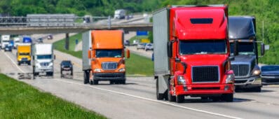
New UC Davis Model Shows Promise in Identifying Optimal Locations of Hydrogen Refueling Stations for Medium- and Heavy-Duty Trucks in California

Abstract

Researchers at UC Davis developed “Spatial Transportation Infrastructure, Energy, Vehicles, and Emissions (STIEVE),” an optimization model for hydrogen refueling stations in California. The model uses inputs from the California Statewide Travel Demand Model (CSTDM) and other sources to determine heavy-duty vehicle travel demand across the state, and the corresponding, localized energy demand. The model then determines which of the transportation analysis zones (areas based on census geography used to replicate areas of trip origins and destinations) delineated by the CSTDM are optimal areas for refueling stations and the number of stations needed in each zone to meet demand while minimizing costs. The final step is a suitability analysis that identifies each station’s specific location within a designated transportation analysis zone, based on a determined footprint for the refueling station.

research report

Making Transit Safe to Ride During a Pandemic: What Are The Risks and What Can Be Done in Response?

Abstract

The Covid-19 pandemic dramatically curtailed travel in the spring of 2020 and more moderately in the months that followed. Travel on public transport declined more and remains lower than on other travel modes, such as driving, biking, and walking. Although public transit operators have implemented various measures to reduce the risk of infection for both riders and employees, the fear that public transport poses a high risk for transmission of infectious disease is widespread. Since the onset of the Covid-19 pandemic, debates have raged in the popular and academic literature regarding the safety of public transit systems and the role they may play in spreading the disease. To inform this debate, the research team reviews the public health literature on the spread of communicable diseases on public transport and concludes that current debates over public transit safety with regard to infection risk have tended to simplify a complex question that depends on numerous factors, many of which are well beyond the control of public transit operators. The paper draws on published studies of previous epidemics and the current pandemic to show that 1) there is a risk of infection on public transport, but the relative magnitude of the risk is often lower than in many other settings including households, workplaces, schools, restaurants, and hospitals; 2) both the broader public health response and public transit agency actions can meaningfully reduce the risks of transmission; and 3) public transport (and indeed all travel modes), by moving people from one place to another, can facilitate the geographical propagation of infections, which can be effectively limited by travel restrictions. The team highlights the multitude of risk factors that can affect infection risk on public transport and argues that public transit systems can be made safe by actions taken by individual riders, public transit operators, and, most importantly, by community-wide public health responses.

research report

Who Has Access to E-Commerce During the COVID-19 Pandemic in the Sacramento Region? Implications for Future E-Commerce and Shopping Tripmaking

Abstract

The COVID-19 pandemic brought about dramatic shifts in travel, including shopping trips. The research team investigated changes in e-shopping for food and non-food items by supplementing an April to May 2018 household travel survey (n=3,956 households) conducted by the Sacramento Area Council of Governments (SACOG) with a May 2020 follow-on panel survey (n=313 households) during one week early in the pandemic. Results demonstrate that impacts from added pickups and deliveries in the SACOG region during the first two months of the COVID-19 pandemic were limited and did not overwhelm curb management at retail, restaurant, and grocery establishments. Results also show that during the pandemic e-commerce tended to replace non-food shopping trips, but complemented restaurant and grocery trips. However, Forty percent of the sample households — predominantly lower income and/or older populations — still shopped only in-store for food while more affluent households appear to have isolated themselves from virus exposure through more extensive online shopping. The researchers recommend extending the forms of accepted payment for online shopping and reducing fees and markups based on payment methods to reduce barriers to online shopping for those with limited resources. The research paper identifies possible consequences (e.g., more vehicle miles traveled and higher demand for curbside parking) if e-commerce food purchasing continues to grow post-pandemic or if in-person retail shopping returns to normal.

dataset

Open-source Code for Street Network Geometry Projects – Global and California

Abstract

Open-source code to allow other researchers to extend the analysis: https://github.com/amillb/streetwidths

Please reach out to the project Principal Investigator for more information.

research report

Synergies of Combining Demand- and Supply-Side Measures to Manage Congested Streets

Abstract

An agent-based, multichannel simulation of a downtown area reveals the impacts of both redistributing traffic demand with time-dependent congestion pricing, and supplying extra capacity by banning left turns. The downtown street network was idealized and loosely resembles central Los Angeles. On the demand side, prices were set based on the time of day and distance traveled. On the supply side, left-turn maneuvers were prohibited at all intersections on the network. Although both traffic management measures reduced travel costs when used alone, the left-turn ban was much less effective than pricing. When combined with pricing under congested conditions, however, the left-turn ban’s effectiveness increased considerably—it more than doubled in some cases. Furthermore, the two measures combined reduced travel costs in synergistic fashion. In some cases, this synergistic effect was responsible for 30% of the cost reduction. This strong synergy suggests that turning bans should be considered as an added option when contemplating congestion pricing.

website

streetwidths.its.ucla.edu

Abstract

The width of street rights-of-way is normally determined by traffic engineering and urban design conventions, without considering the immense value of the underlying land. This storyboard discusses the regulations around street width.

Please reach out to the Principal Investigator for more information on this website.

policy brief

A Mobile and Cost-Effective Computational Technology to Analyze Brake and Tire Wear Emissions

Abstract

Researchers developed a portable computational imaging and deep-learning enhanced aerosol analysis device (c-Air) to identify and measure particulate emissions directly from traffic sources. Researchers found that significantly higher numbers of particles were collected per second when the car was in motion compared to the background particle levels measured when the vehicle was stationary. In addition, even more particles were generated during acceleration and braking. This mobile and cost-effective device is able to distinguish non-volatile as well as volatile and evaporating particles caused by brake and tire wear generated by a moving vehicle from background road dust, with a high degree of accuracy in the field. In addition to counting and sizing particles, this system can also classify particles based upon physical features, shape, color and volatility using computational imaging and deep learning.

presentation

Turning streets into housing

policy brief

Smart Charging of Electric Vehicles Will Reduce Emissions and Costs in a 100% Renewable Energy Future in California

Abstract

California has goals of achieving 100% renewable energy by 2045 and 100% zero-emission vehicle sales by 2035. Electric vehicles will introduce significant new demand for electricity at the same time the state’s electricity grid is incorporating more intermittent energy sources, raising concerns about grid reliability. However, the flexibility of electric vehicle charging provides a potentially powerful asset in mitigating the challenges of a renewable energybased electricity grid. Smart charging—adapting electric vehicle charging based on the conditions of the power system and the needs of the vehicle user—can take advantage of this flexibility by charging vehicles when renewable energy is readily available. Researchers at UC Davis simulated 100% electric vehicle adoption and a 100% renewable energy-powered electricity grid by 2045 in California. They then compared a scenario of regular electric vehicle charging behavior with a scenario of advanced, flexible, smart charging under which charging is aligned with renewable energy availability, to understand how smart vehicle charging could benefit the electricity grid.

research report

Spatial Modeling of Future Light- and Heavy-Duty Vehicle Travel and Refueling Patterns in California

Abstract

A spatial optimization model was developed for deploying, over the next two decades, hydrogen refueling stations for heavy-duty zero-emission hydrogen vehicles. The model assigns trips to vehicles by applying a routing algorithm to travel demand data derived from another model—the California Statewide Travel Demand Model (developed by the California Department of Transportation). Across a range of adoption levels of hydrogen fuel-cell truck technology, from 2020 through 2030, the results suggest that heterogeneity of travel demand may necessitate an extensive distribution of refueling stations, which may lead to low utilization of stations in the short term. To efficiently employ the capacity of stations, a certain volume of vehicle adoption must be met, and/or truck routes must be planned and committed to specific roadways. Once the number of stations reaches a threshold to meet the principal demand in affected transportation area zones, a small set of smaller “top-off” stations can be built to meet marginal excess demand. The best location of a hydrogen refueling station within a transportation area zone also depends on criteria such as land cover, slope, and distance from gas stations, truck hubs, and the truck network.